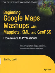
Beginning Google Maps Mashups
with Mapplets, KML and GeoRSS:
From Novice to Professional
by Sterling Udell
G70.212 .U34 2009
New Book Island, 2nd floor
Last week as I worked with a class on a research project, the question came up – “How do you calculate the distance between Chennai (India) and Long Beach, CA… in nautical miles?” While I totally knew the answer in my head, I searched for a solution that would allow the students to find out this for themselves. Enter the Google Maps Distance Calculator from Daft Logic. You plot your two points wherever you’d like and it automagically figures out the distance, in miles, kilometers, nautical miles, meters and FEET. All of this is possible because of a what’s affectionately known as a mashup. (In case you’re wondering, the distance between Chennai and Long Beach measures out to approximately 7800 nautical miles.)
I tell this story because this week’s featured title details just how to make your very own mashup. Udell, having developed with Google Maps since before its release to the public, shares his expertise with the Internet giant’s geographic code and its applications in web design. He provides this information in an accessible volume, stating upfront that the reader need not have programming experience (just not an aversion to it) to utilize this book. The author starts off easy with walking you through the Geoweb and setting up a maps page, and guides you as you explore the possibilities with mapplets. If you’ve ever wanted to put together a mashup but didn’t know how, this book will get you on the right track.
